Polycam
Visual Design
UX/UI
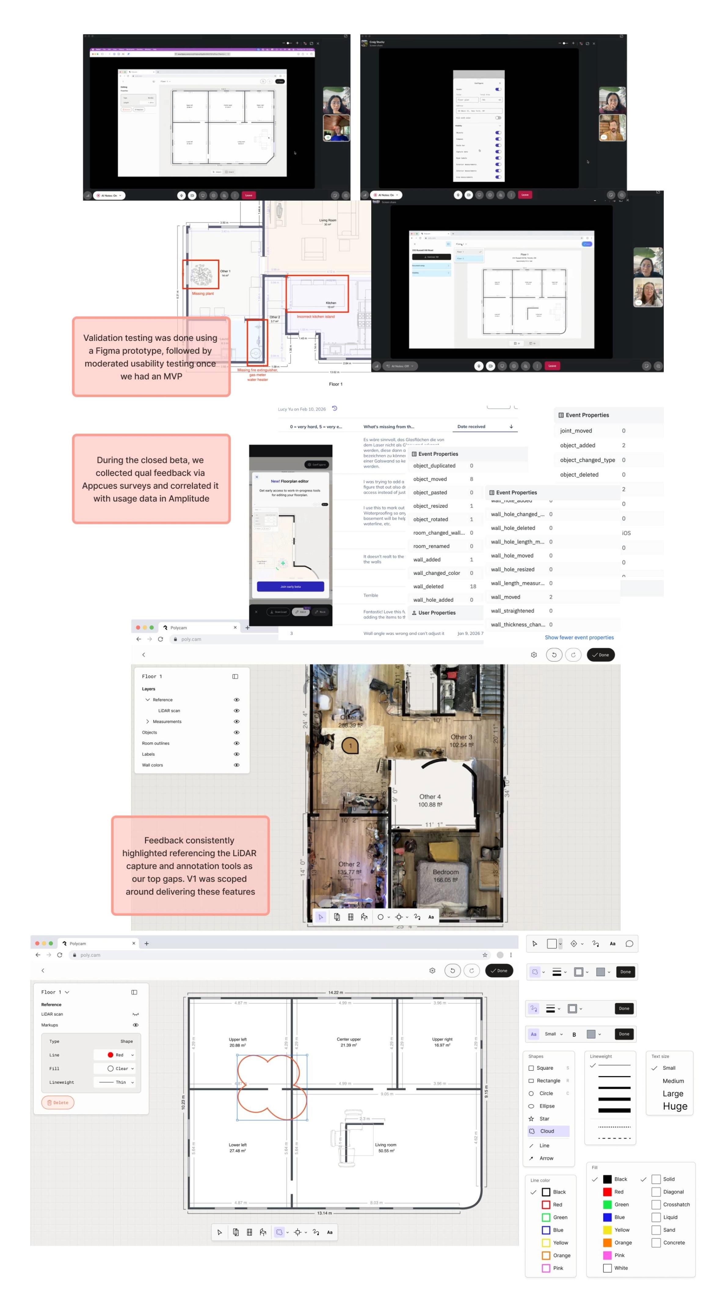
Validation Testing
Product Management
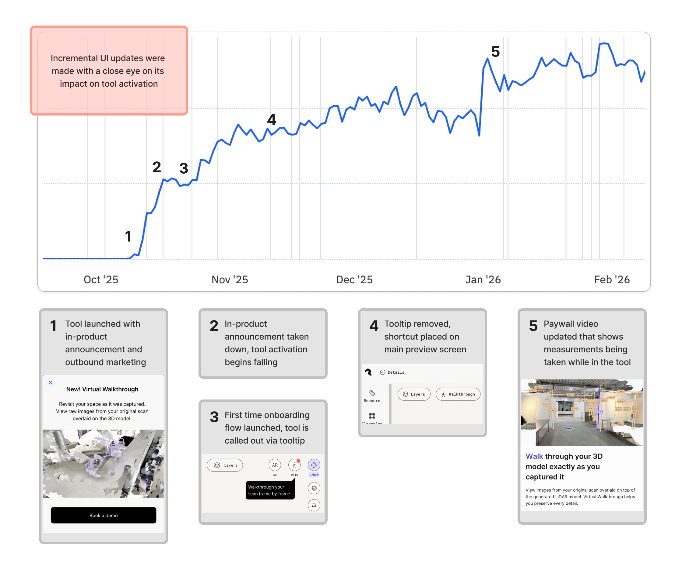
Virtual Walkthrough introduces a human-scale navigation mode that overlays images captured during the original scan on top of the 3D model. This feature generated $400k+ in pro revenue in the first 6 months of launch.
Initially designed with a collapsible menu, Virtual Walkthrough saw lower-than-expected activation due to discoverability issues rather than lack of utility. I identified this through usage data and added a contextual callout on first open, increasing daily activations from ~1,500 to over 3,000.
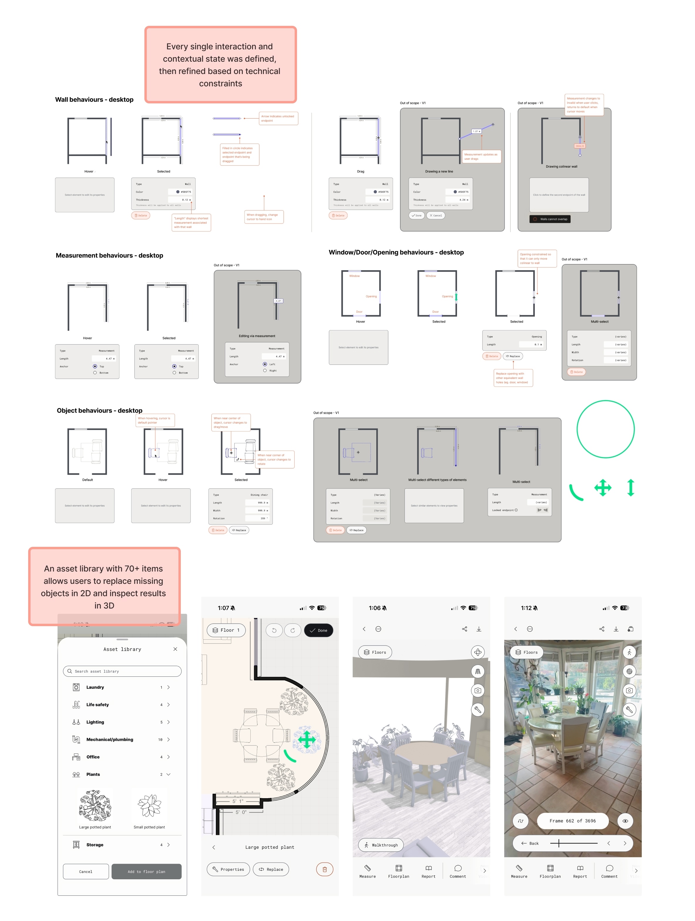
Polycam could generate dimensioned floorplans from a capture, however results were rarely 100% accurate. Acting as a designer, researcher, PM, and PMM, I managed a team of 3 engineers to launch a brand new set of tools for professionals to review, edit, and annotate their spatial data in 2D and 3D.
Currently in closed beta, the editor attracted 700+ signups within the first 24 hours of launch and has been used to edit half a million square feet of spatial data.